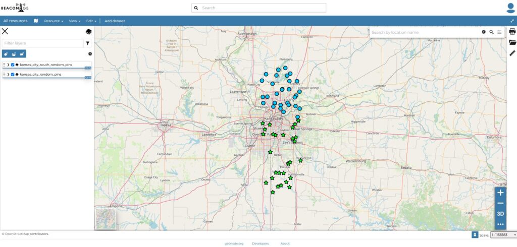
Closed Pre-Alpha Goes Live
Pre-alpha is where we will be setting up and designing all of the various components prior to formal testing. The basic building blocks of BeaconGIS are laid and ready to be modified to our heart’s desire at this stage.
BeaconGIS is a GIS service built for Urban Explorers, by an Urban Explorer to cater to the unique needs of our underground communities worldwide. This platform overcomes the limitations often reached by explorers who utilize Google MyMaps, offering unparalleled levels of functionality, flexibility, and collaboration.
BeaconGIS is built of robust open-source technologies – including Ubuntu, Docker, GeoNode, GeoServer, PostGIS, QGIS, and many others. BeaconGIS will allow you to create, import, manage, and share maps that are both comprehensive and highly customizable. Whether you’re organizing and pinning abandoned structures or developing intricate maps of sewers and mines, BeaconGIS will be there to help you document the world like never before.

BeaconGIS is currently running virtualized on a recycled (we <3 the earth) Dell Poweredge 730 with the following specs:
Dependent on the usage, we may explore splitting regions across separate instances of BeaconGIS.
BeaconGIS is currently in heavy development. We reached our Pre-Alpha on July 14th, 2025. As we continue with development, we hope to reach Closed-Alpha by November of 2025. Large-scale testing should commence shortly after in the Winter of 2026.
As mentioned prior, BeaconGIS is in heavy development. In Pre-Alpha and Alpha stages, expect outages, errors, data loss, and various other issues. As we progress through our roadmap, community members will be invited to test the platform, provide feedback, and help shape its development. This system will be slightly more technical to setup than Google MyMaps, but the learning curve is very short. Our service is intended to make you into a more advanced cartographer over time, enhancing your exploration and mapping skills.
Pre-alpha is where we will be setting up and designing all of the various components prior to formal testing. The basic building blocks of BeaconGIS are laid and ready to be modified to our heart’s desire at this stage.
At this phase, we will open up invite-only, closed, formal testing with a small group. During Alpha, BeaconGIS will likely be missing some key features, have random bugs/performance issues, and might experience data loss. The Alpha version will be geofenced to our local area until testing is complete.
Once the Alpha version completes its testing period, we will open our geofence to a select number of major cities and integrate our planned waitlist-based invite system. Through this system, you will be able to request early access and join our Beta testing program. At this time, BeaconGIS will have most or all of the promised features, and should be stable enough for active daily use.
Once the Beta version has been properly and thoroughly tested, BeaconGIS will expand to the entirety of the US. A form will be added to our website to join the wait-list. To keep the service secure, we will be only accepting applications from those who are verified and vouched for.
May 2026 is a generous estimate for when this will be available.
The BeaconGIS Archival Project is an ambitious initiative aimed at preserving vital GIS data related to Urban Exploring from public GIS REST servers. Drain, sewer, tunnel, mine, cave, and other maps were often published publicly in government GIS systems, but more recently, they are being privatized behind credentials.
This project will create a digital archive, capturing historical and current data relevant for exploring, organized and styled for ease of use. We hope this will foster a collaborative environment within communities around the world; allowing us all to learn and share with our respective communities. This archival effort will serve as both a time capsule and and living library, ensuring the data we archive remains relevant and usable for years to come.
This is currently being done free hand, using Google Dorking techniques to find and connect to various ArcGIS REST servers around the world. We take these datasets, filter the data if needed, then archive them on BeaconGIS; making them available to the respective communities to trusted individuals.
If you’d like to join the archival effort, we will be sharing a way you can apply soon.
Above numbers are as of: 7-28-2025
I’ll be honest, I’m the typing this introduction myself so I’ll try to be brief explaining my qualifications. I’ve been in the IT field since 2016, after graduating from a vocational IT Administration program. I’m currently a Microsoft Engineer, specializing in administrating various Microsoft products. I have a number of different IT certifications from CompTIA and Microsoft.
Since 2017, I’ve been heavily involved in my local community, taking over KCUrbEx from the previous administrator who had managed the site since 2005. Over the last eight years, I’ve been entrusted with handling sensitive data related to urban exploration across the midwest underground communities. In 2024, I was honored to receive the “Explorer of the Year” award at a private urbex event, in recognition of my dedication and contributions to the urbex community.